The Global Positioning System provides worldwide navigation and timing services through a network of satellites operated by the U.S. Space Force. This revolutionary technology delivers precise location data to anyone with a GPS receiver.
How GPS Works
A constellation of 31 operational satellites orbits Earth at 20,180 kilometers above ground. Each satellite broadcasts radio signals containing its position and precise time from atomic clocks. Your GPS receiver needs signals from at least four satellites to calculate your exact location and elevation.
Military Origins Shape Modern Use
The U.S. Department of Defense started GPS in 1973 to improve military navigation. It became fully operational in 1993. After the tragic downing of Korean Air Lines Flight 007 in 1983, President Reagan made GPS available for civilian use.
Accuracy Evolution
From Restricted to Precise
Early civilian GPS had intentional errors called Selective Availability, limiting accuracy to 100 meters. President Clinton removed these restrictions in 2000. Now, consumer devices achieve 4.9-meter accuracy, while professional equipment can pinpoint locations within centimeters.
System Architecture
Space Segment
Twenty-four satellites form the core constellation, arranged in six orbital planes. Each satellite completes two Earth orbits daily, ensuring at least six satellites are visible from any point on Earth.
Control Segment
The Master Control Station at Schriever Space Force Base coordinates the entire system. A network of monitoring stations tracks satellite positions and maintains precise timing.
User Segment
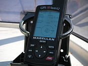
Millions of civilian and military users rely on GPS receivers. These devices combine signals from multiple satellites to determine position, speed, and time.
Modern Applications
GPS now powers countless everyday technologies:
- Banking systems require GPS timing
- Mobile phones use GPS for location services
- Power grids depend on GPS synchronization
Future Developments
The next-generation GPS III satellites will provide stronger signals and better accuracy. The modernization includes new civilian signals and improved security features to maintain GPS’s role as the world’s premier navigation system.
Citations:
https://en.wikipedia.org/wiki/Global_Positioning_System
The Global Positioning System (GPS), originally Navstar GPS, is a satellite-based radio navigation system owned by the United States Space Force and operated by Mission Delta 31. It is one of the global navigation satellite systems (GNSS) that provide geolocation and time information to a GPS receiver anywhere on or near the Earth where there is an unobstructed line of sight to four or more GPS satellites. It does not require the user to transmit any data, and operates independently of any telephone or Internet reception, though these technologies can enhance the usefulness of the GPS positioning information. It provides critical positioning capabilities to military, civil, and commercial users around the world. Although the United States government created, controls, and maintains the GPS system, it is freely accessible to anyone with a GPS receiver.
 GPS Logo | |
| Country/ies of origin | United States |
|---|---|
| Operator(s) | US Space Force (Mission Delta 31) |
| Type | Military, civilian |
| Status | Operational |
| Coverage | Global |
| Accuracy | 30–500 cm (0.98–16 ft) |
| Constellation size | |
| Nominal satellites | 24 |
| Current usable satellites | 31 operational |
| First launch | February 22, 1978 |
| Total launches | 79 |
| Orbital characteristics | |
| Regime(s) | 6 MEO planes |
| Orbital height | 20,180 km (12,540 mi) |
| Orbital period | 1⁄2 sd or 11 hours and 58 minutes |
| Revisit period | 1 sidereal day |
| Other details | |
| Cost |
|
| Website | gps.gov |
English
Etymology
From the proper noun Global Positioning System.
Noun
global positioning system (plural
...


